Climate Dashboard
The DiCRA Climate Risk Dashboard provides district-level physical climate risk assessments across nine distinct climate perils — Drought, Earthquake, Fire, Riverine Flood, Cyclone, Precipitation, Heat Stress, Landslide, and Urban Flood.
Dashboard
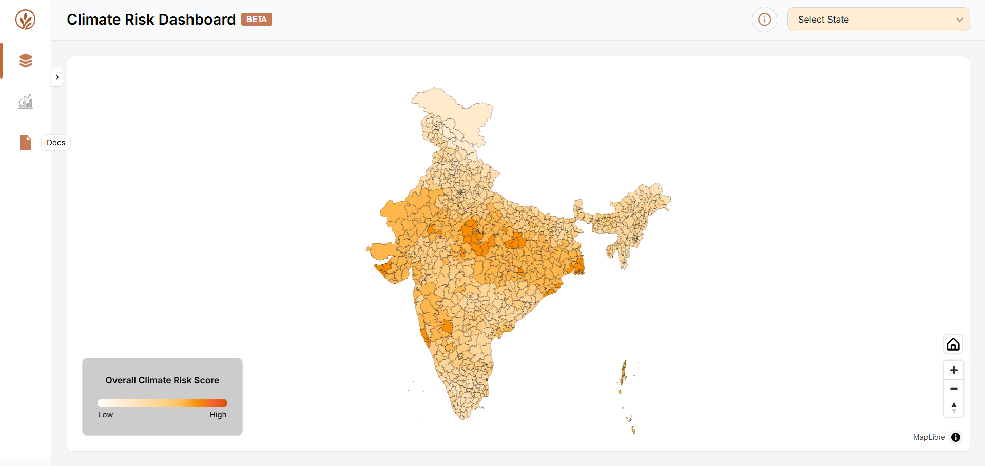
The Dashboard Map view is the primary interface of the Climate Risk Dashboard, with all districts colour-coded by their Overall Climate Risk Score, ranging from light (Low) to dark red-orange (High). A colour legend in the bottom-left corner labelled Overall Climate Risk Score provides a visual reference for interpreting the map. A Select State dropdown in the top-right corner allows users to filter the map to a specific state.
- Use the Select State dropdown in the top-right corner.
- Click on any district polygon on the map to select it and load its detailed climate risk data in the District Risk Info Panel on the right side of the screen.
District Risk Info Panel
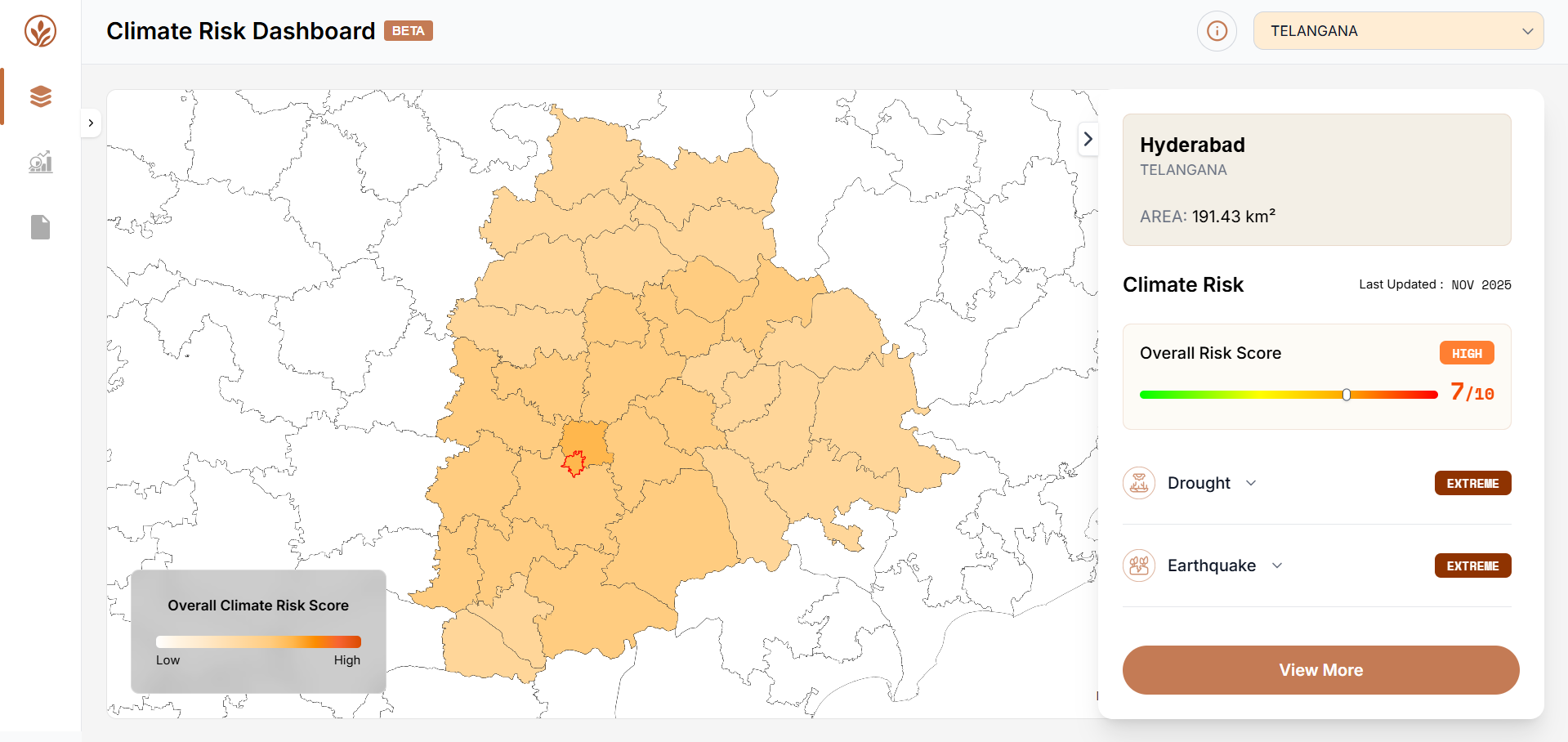
The District Risk Info Panel presents a structured summary of that district's physical climate risk across all nine perils, historical climate trend charts, and options to access further detail or generate a downloadable climate profile. The panel displays the date the risk data was last updated at the top right of the Climate Risk section.
- Overall Risk Score — an overall climate risk score out of 10 is shown prominently with a colour-coded severity label (Low, Medium, High, or Extreme) and a gradient indicator bar ranging from green to red. This score reflects the combined physical climate risk across all nine perils for the selected district.
- Peril-wise risk breakdown — below the overall score, each of the nine climate perils — Drought, Earthquake, Fire, Riverine Flood, Cyclone, Precipitation, Heat Stress, Landslide, and Urban Flood — is listed individually with its own severity label (Low, Medium, High, or Extreme).
- Historical Climate Trends — two charts are displayed in the expanded view: a Temperature Trend chart showing daily observed maximum and minimum temperature in °C from 1991 to 2025, and an Annual Rainfall Sum chart showing total yearly precipitation in mm over the same period. These charts help contextualise the current risk scores.
- District Climate Profile — a District Climate Profile button below the historical trend charts generates and opens a downloadable climate risk profile document for the selected district. This document includes the district's geographic profile, historical climate trends, and detailed risk score and risk index information.
Analytics
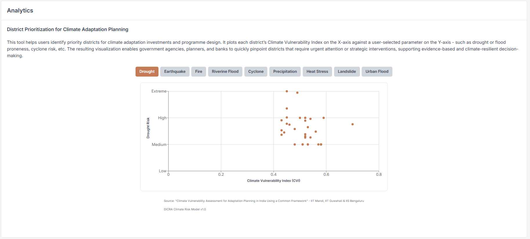
The Analytics section is accessible from the left navigation panel. It is designed to help users identify priority districts for climate adaptation investments and programme design by plotting each district's Climate Vulnerability Index (CVI) against a user-selected peril risk parameter in a scatter chart.
- The analytics view displays a scatter chart with the Climate Vulnerability Index (CVI) on the x-axis and a selected peril risk score on the y-axis. Each point on the chart represents a district, enabling users to compare vulnerability and peril exposure across all districts simultaneously.
- Districts appearing in the upper-right quadrant of the chart (high CVI and high peril risk) represent the highest-priority areas for adaptation intervention. These are the districts that combine broad climate vulnerability with elevated exposure to a specific hazard.